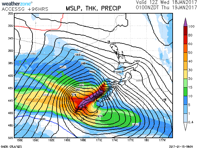
A front should pass over the South Island during Tuesday and weaken as it moves north. Another, more significant front is expected to move onto the lower South Island late Tuesday, then cross much of the South Island on Wednesday and the rest of the country on Thursday. Each of these fronts are expected to bring periods of heavy rain to western areas and strong winds in the east.
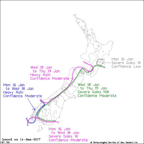
For Fiordland, there is moderate confidence that heavy rain warnings will be required from Monday to Wednesday.
For Westland, Buller, northwest Nelson and the Tararua Range there is moderate confidence rainfall accumulations will meet warning criteria on Wednesday and Thursday.
Strong to gale northwest winds are likely to affect eastern areas of the South Island and southern North Island for extended periods during the outlook.
For Central Hawkes Bay, there is low confidence that westerly winds will reach warning strength for a time early Monday.
For Wairarapa, Wellington and the east of the South Island, there is moderate confidence of severe northwest gales on Wednesday and Thursday.
Finally, for coastal Southland and Stewart Island, there is moderate confidence that westerly winds will rise to severe gale at times from Monday to Wednesday.

