Heavy rain and gale force winds across central New Zealand
 Heavy rain and gale force winds across central New Zealand
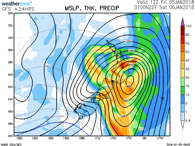
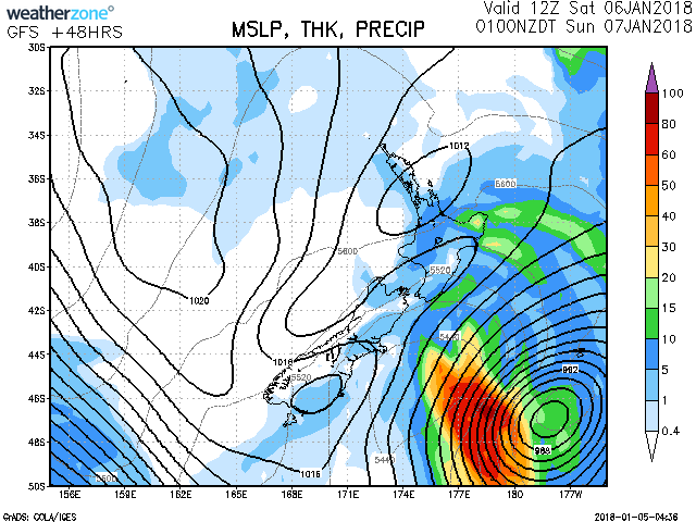
A deep low is forecast to move southeastwards across central New Zealand tonight, delivering heavy rain and strong winds across much of the North Island and the upper South Island.
The heaviest rain is expected about Mount Taranaki, Tongariro National Park, the eastern ranges of Bay of Plenty, also Marlborough, and WARNINGS for heavy rain are in force for these areas. This Watch covers the possibility of rain approaching warning criteria in the area from Waikato to Taranaki excluding the mountain, the central North Island high country and the remainder of Bay of Plenty not under warning. Also, for Wellington, the Tararua Range and Canterbury.
Severe gales are expected in exposed places across the North Island, also Marlborough and north Canterbury during today and Saturday, with WARNINGS and WATCHES in place.
Note, the combination of strong winds and high tides have caused coastal inundation in eastern areas from Northland to Bay of Plenty including the Firth of Thames, but may also cause inundation in western and southern areas, especially along Wellington's south coast from tonight as the winds change southwest.
People are advised to remain up to date with the latest forecasts in case this WATCH is upgraded to a full WARNING, or other areas are added.
Heavy Rain WatchArea: Waikato, Waitomo, Taumarunui, Taupo, Taranaki excluding the mountain, the Whanganui Hill Country and Taihape
Forecast: Rain with some heavy falls and possible thunderstorms is expected from this morning until late afternoon or evening. During this time, rain accumulations may approach short duration warning criteria.
Area: Bay Of Plenty west of Opotiki
Forecast: Rain with heavy falls is expected this afternoon. During this time, rain accumulations may approach short duration warning criteria.
Area: Wellington including the Tararua Range
Forecast: A period of rain is expected this afternoon and evening. During this time, some heavy falls are possible and rain accumulations may approach short duration warning criteria.
Area: Christchurch, Canterbury Plains, Canterbury High Country
Forecast: Rain may become heavy at times especially about the Canterbury High Country and Foothills until tonight. During this time, rain accumulations may approach warning amounts.
Strong Wind WatchArea: Hawkes Bay from Napier southwards
Forecast: Southwest winds may become severe in exposed places from overnight tonight until Saturday afternoon.
Area: Taihape, Whanganui, and Manawatu
Forecast: East to northeast winds may become severe in exposed places this morning until mid-afternoon today, then the winds should ease a little.
Winds then change west to southwest this evening, and may become severe in exposed places until mid-morning Saturday. Note, the combination of strong onshore southwesterly winds and high tides may cause coastal inundation in coastal parts of Whanganui and Manawatu.
Area: Canterbury, from Banks Peninsula northwards
Forecast: From midnight tonight until midday Saturday, southwesterly winds may become severe in exposed places, especially about the coast including Banks Peninsula.
Source: Metservice.co.nz
weatherzone.com.au


 Share Topic

