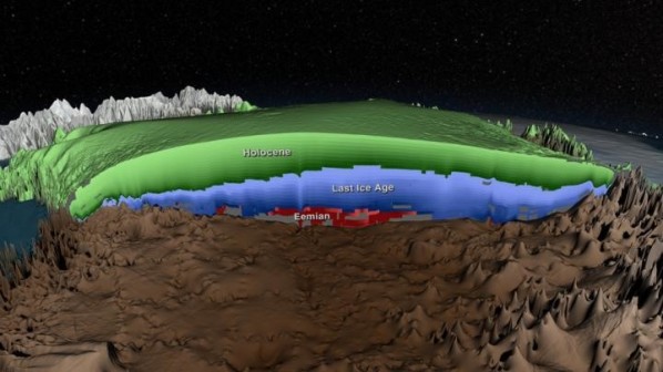
Scientists using ice-penetrating radar have created 3-D maps of the age of the ice within the Greenland Ice Sheet. The new maps will aid future research to understand the impact of climate change on the ice sheet. The Greenland Ice Sheet is the second largest mass of ice on Earth, containing enough water to raise ocean levels by about 20 feet.

This is a cross-section of the age of the Greenland Ice Sheet. Layers determined to be from the Holocene period, formed during the past 11,700 years, are shown in green. Layers accumulated during the last ice age, from 11,700 to 115,000 years ago, are shown in blue. Layers from the Eemian period, more than 115,000 years old, are shown in red. Regions of unknown age are gray.
Greenland's ice sheet has been losing mass during the past two decades, a phenomenon accelerated by warming temperatures. Scientists are studying ice from different climate periods in the past to better understand how the ice sheet might respond in the future.
more:
http://www.sciencedaily.com/releases/2015/01/150123140943.htm