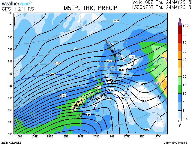
Forecast in Brief for Thursday the 24th May 2018 Northland to Manawatu, including Coromandel Peninsula, Bay of Plenty, Taupo, Taumarunui, Taihape
Showers, some heavy with hail and thunderstorms, easing for a time overnight and tomorrow morning.
Gisborne, Hawkes BayFine breaks. A few showers, mainly about the ranges.
Horowhenua to Wellington, Wairarapa, Canterbury and MarlboroughShowers, possibly heavy north of Kaikoura, clearing tonight. Showers return tomorrow afternoon or evening, but remaining dry about Canterbury Plains.
NelsonShowers developing about the western ranges tomorrow, then spreading east at times.
Buller, Westland, FiordlandShowers about Fiordland spreading elsewhere tonight. Squally showers tomorrow, with thunderstorms and hail. Heavy snow above 400 metres south of Haast tomorrow.
Otago, SouthlandShowers, with snow to 300 metres at times, clearing for a time this evening and overnight. Thunderstorms in the south tomorrow.
Chatham IslandsPeriods of rain.
Source: Metservice NZ & Weatherzone AU