|
|
|
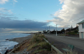
| NW Frontal 5 Oct 2012 |

|
| Previous Image | Next Image
|
Description: As it so often happens, As the NW front came over Kapiti Island, the island started convecting and sending clouds into the mainland at Paekakariki where I live. During a NW, the cloud coming off Kapiti often forms a big arc as it curves around and heads south into Mt Wainui, via us. Mt Wainui is an 800m mountain and part of the Akatarawa range, which looms up behind the north end of Paekakariki. It is responsible for much of the localised orographic weather we get here. Yesterday's front looked very ominous, but did not drop any rain.
Picture Stats:
Views: 2710
Filesize: 60.74kB
Height: 1200 Width: 1600
Posted by: cupoteacoast October 06, 2012, 05:42:29 PM October 06, 2012, 05:42:29 PM
Exif data
| Date Taken |
October 5, 2012, 9:43 am |
Rating:  by 1 members. by 1 members.
|
| 0 Members and 1 Guest are viewing this picture. |
| Related Images |
Sou Wester 19 Oct 2012


Views: 2344
Date: October 20, 2012, 04:45:26 PM
Comments (0)
By: cupoteacoast
| Sou Wester 19 Oct 2012

Views: 2265
Date: October 20, 2012, 04:48:59 PM
Comments (0)
By: cupoteacoast
| Sou Wester 19 Oct 2012
Views: 2806
Date: October 20, 2012, 04:56:50 PM
Comments (0)
By: cupoteacoast
| Frontal Cloud

Views: 3165
Date: July 01, 2014, 03:27:40 PM
Comments (4)
By: intrepid
|
|
|


